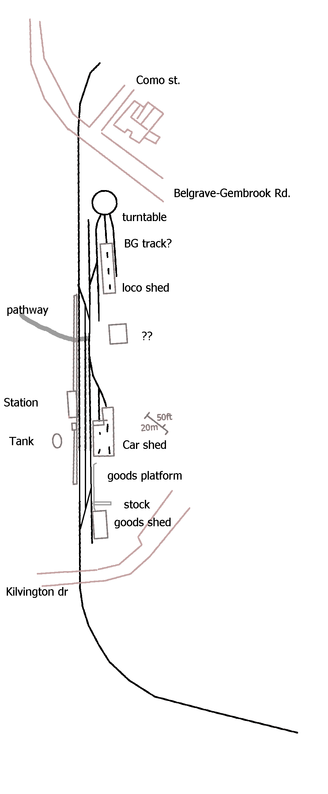
Update 18th November 2010 The first impression of the layout of Emerald. 'Drawn' off a google map it shows releatively the layout to scale. I screen captured the google view then drew lines across it etc and eventually removed the image as such, leaving the lines drawn over the original, so it is roughly scale. Because of the resolution and trees it is hard to see the track, which is a pity. I have to guess where the point at each end start/finish to make the three roads. I will have to do more research before I start, but I want to model the track right to allow my stock to clear on every loop. Actual layout I think will be about 18ft toal length and about 8ft width. Only the fron tis full sized modules, the ends basically single track troughs, and a small narrow stagin yard at the back. I plan to use the lakeside end which curved from the road to good effect, the scenery ending when it gets 90%. At the belgrave end the track will be wrongly curving in the opposite direct, but the scenery here will be th ehouse near the level crossing and that's it. It means the public look at the layout from the tree side of the station looking to the township. I'll have to debate with myself if I just reperesent a backscene for that or some partial low relief rear ends. For the staging yards, I'm thinking of finding a old aluminuim ladder, cutting ends off and just screwing a wooden top on. Light enough etc.! |
|||
Page written & maintained by David Head.david@nmit.vic.edu.au